Great Whelnetham
#1068
Search:
Google images eBay wikipedia YouTube

(
52.20496,
0.74805)
Map/aerial photo of the area around the mill
Tutelina Mills:
tower mill
function:Corn mill
- derelict, but kept watertight

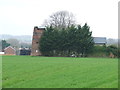
Great Whelnetham windmill, seen from the pillbox over the road, 11/5/26
© Mark Berry
Entry in Mills Archive database -
#1068 - Tutelina Mills, Great Whelnetham
(1) Geograph images are licenced under a Creative Commons Attribution-Share Alike licence
Wikipedia entry
Flickr images are copyright their individual photographers.
Images from Historic England - hover over image to see copyright info, and to enable zoom
Stanningfield Road, Great Whelnetham, St Edmundsbury, Suffolk, IP30 0UB
2 Aug 2002 - Photograph (Digital)
|
International Mill Database Entry |
|---|
| name |
Clarke's Mill |
| id |
48969 |
| description |
Disused tower mill built 1865 with adjacent oil engine driven mill |
| drive power recent |
none |
| drive power originally |
windmill |
| mill type |
tower mill |
| function type |
grain mill |
| condition type |
abandoned |
| map location |
52.205015,0.74808 |
| country |
United Kingdom |
| state |
England |
| county |
Suffolk |
| municipality |
Bury Saint Edmunds |
| city |
Great Whelnetham |
| zip |
IP30 0UB |
| street |
Stanningfield Road |
| logo detail |
windmill_nophoto |
| construction year |
1865 |