Windmills of Montserrat 🌍


Sites identified in 2020

Research by Miriam Rothenberg published in Wind-Powered Sugar Mills as Constructions of Control in Colonial Montserrat, International Journal of Historical Archaeology, 2020 has located 45 windmill locations on the island of Montserrat. Unfortunately, due to volcanic activity on the island, about half the island is an exclusion zone, so many of those sites identified are actually off limits.

My thanks to her for sharing the names and locations of those mills with me.

Other surveys etc

1673 map

The 1673 map/panoramic view of Montserrat shows two labelled windmills:

1729 Census

The 1729 Census of Montserrat lists 23 windmills, 3 water mills, and 52 cattle mills on the island.

Oxford Archaeological Unit survey May 1995

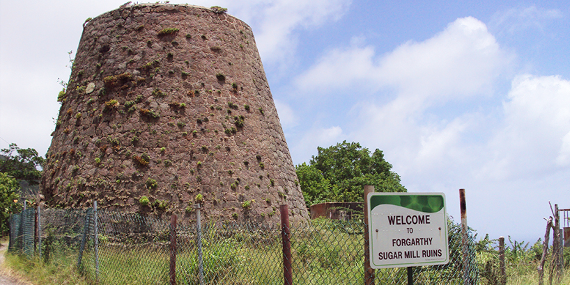
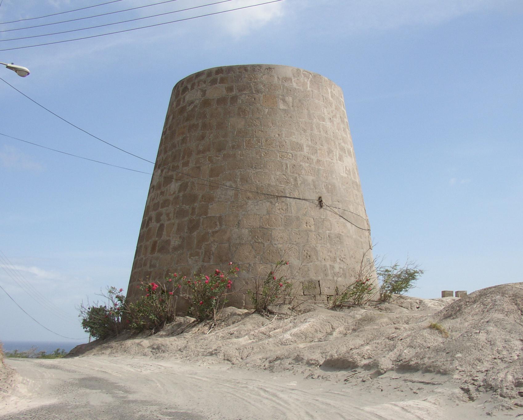
This survey documented 50 of Montserrat's sugar estates, with 33 of those noted as having windmills.

Survey and Landscape Archaeology on Montserrat (SLAM) (2010-2018)

Undertaken after the volcanic closures, this documented 55 prehistoric and colonial sites in the northern part of the island, with 20 windmills recorded.

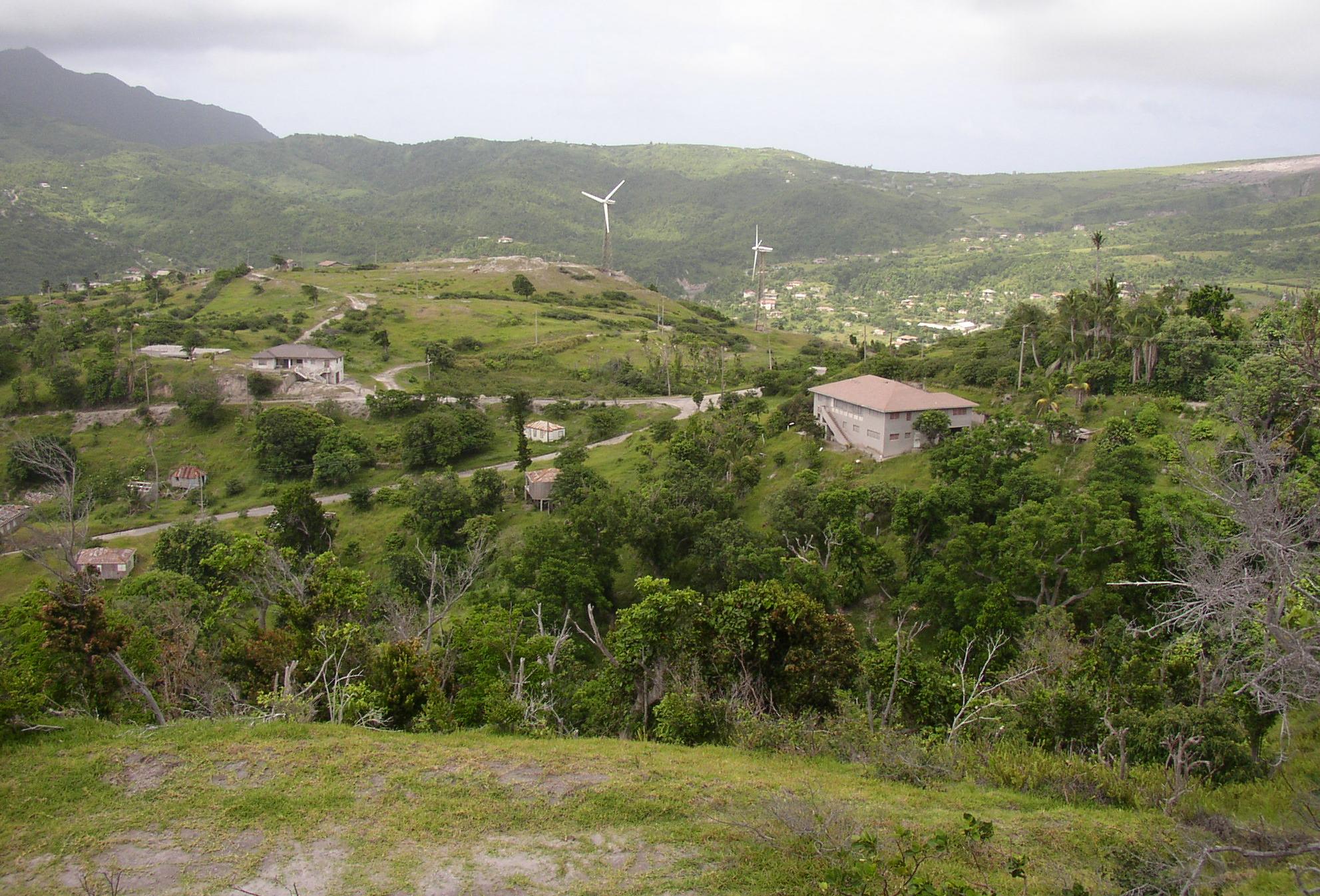
Wind energy on Montserrat

There have been 2 wind turbines on St Georges Hill since the late 1980's when MONLEC installed a 215-kilowatt demonstration project. These were put out of commission due to volcanic activity on the island, and hurricane damage.


Remaining Mills

Amersham (#ms1)

(16.70508,-62.207)

Baker Hill (Lower) (#ms3)

(16.77698,-62.205)
Old Sugar Mill guest house: - Converted into guest house accomodation.
[photo] [photo] [photo]

Baker Hill (Upper) (#ms2)

(16.77626,-62.205)
[photo] [photo]

Barzeys (#ms4)

(16.78097,-62.198)
- ruinous
[photo]

Bethel (Tuitts) (#ms5)

(16.74613,-62.156)

Blakes (#ms6)

(16.78766,-62.184)

Brades (#ms7)

(16.78616,-62.207)
- full height tower, rendered and well maintained, with remains of sugar mill rollers alongside the tower
[photo]

Bramble (#ms8)

(16.73851,-62.163)

Delvins (#ms9)

(16.72801,-62.219)

Drummonds (#ms10)

(16.80208,-62.196)

Duberry/Cassava (#ms11)

(16.76011,-62.216)

Dyers (#ms12)

(16.72917,-62.193)

Elberton (#ms13)

(16.72241,-62.230)

Fairy Walk (#ms14)

(16.74977,-62.180)

Farm (#ms15)

(16.75198,-62.159)

Farrells (#ms16)

(16.73241,-62.181)
- surrounded by the volcanic flow
[photo]

Fogarthy (#ms17)

(16.77582,-62.210)
- full height tower, bare stone faced
[photo] [photo] [photo] [photos]

Gages (#ms18)

(16.71774,-62.201)

Galways (Lower) (#ms19)

(16.68964,-62.194)
Artist's impression of Galaways sugar mill on a stamp celebrating the 25 anniversary of the National Trust, 1995

Flickr images are copyright their individual photographers.

Galways (Upper) (#ms20)

(16.69543,-62.187)

Grove (#ms21)

(16.71393,-62.218)
[drawing]

Hermitage (#ms22)

(16.72702,-62.161)
[photo]

Hodges (#ms23)

(16.73204,-62.196)

Isles Bay (#ms24)

(16.73690,-62.226)

Locust Valley (Lower) (#ms26)

(16.75781,-62.172)

Locust Valley (Upper) (#ms25)

(16.75741,-62.174)
[photo]

Lookout Yard (#ms500)

steam driven:

Built by Bhudda Allen, in 1921, but damaged in the 1928 Okeechobee hurricane. Donated into public ownership in 1999. Steam driven machinery still in place.

Signboard says:
Lookout Yard Sugar Mill
Built in 1921 by Bhudda Allen
Destroyed by hurricane in 1928
Donated to the people of Montserrat February 9, 1999 by Peggy Scott
[photos] [info] [info] [photo] [photo]

Flickr images are copyright their individual photographers.

Molyneux (#ms27)

(16.73242,-62.199)

Mulcares (#ms28)

(16.72791,-62.156)

Paradise (#ms29)

(16.73142,-62.173)

Parsons (#ms30)

(16.70928,-62.207)

Reid’s Hill (#ms31)

(16.69155,-62.201)

Rendezvous (#ms32)

(16.81057,-62.197)

Richmond Hill (#ms33)

(16.71749,-62.220)
- Was repaired and maintained to house the national museum, but now closed.
Montserrat musuem in a series of National Trust properties on stamps, 1981
Montserrat musuem on first day cover celebrating the 25 anniversary of the National Trust, 1995

This windmill, the sugar mill for the Richmond estate, was deeded to the Montserrat National Trust by the Montserrat Company in 1975. In 1976 the Trust opened it as the Montserrat National Museum, which it operated as such until closed due to the volcano in 1996.

Signboard says:
This property is a gift to the Montserrat National Trust from the Montserrat Company Limited 1975
[info] [photo] [photo] [photo] [photo] [photo] [photo] [photo] [photo]

Flickr images are copyright their individual photographers.

Riley’s (#ms34)

(16.72979,-62.184)

Roche’s Yard (#ms35)

(16.70397,-62.153)

Spring (#ms36)

(16.69940,-62.197)

St Georges Hill (#ms100)

(16.72448,-62.204)
Vestas wind turbine:
[photo]

Flickr images are copyright their individual photographers.

St Georges Hill (#ms101)

(16.72394,-62.204)
Vestas wind turbine:
[photo]

St. George’s Hill (#ms37)

(16.72509,-62.204)

Streatham (#ms38)

(16.73340,-62.185)

Sweeneys (#ms39)

(16.79000,-62.198)

Trants (#ms40)

(16.75992,-62.160)
- part buried by the volcano
Trants sugar mill, on the cover of: Montserrat, History of a Caribbean Colony, by Howard A Fergus, 1994
[photo] [photo]

Unidentified (#ms999)

[photo] [photo] [photo]

Flickr images are copyright their individual photographers.

Waterworks (Lower) (#ms42)

(16.73609,-62.206)

Waterworks (Upper) (#ms41)

(16.73907,-62.211)
[photo]

Webbs (#ms43)

(16.71036,-62.214)

Weekes (#ms44)

(16.73025,-62.207)

White’s Yard (#ms45)

(16.73232,-62.159)


[Windmills] [Watermills] [Bookshop] [News] :

Last updated 16/04/2026 Text and images © Mark Berry, 1997-2026 -