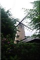
Ewhurst
#2575
Search:
Google images eBay wikipedia YouTube
NGR:
TQ078427
(
51.17270 ,
-0.4601 )
Map/aerial photo of the area around the mill
Hurt Wood Mill :
tower mill
function:Corn mill
- residential conversion
Ewhurst,
, c1935
Ewhurst,
, c1930s
Ewhurst,
, c1930s
[
details ]
[
photo ]
[
old photo ]
Entry in Mills Archive database -
#2575 - Hurt Wood Mill, Ewhurst
(has photos )
Muggeridge Collection photos
(5) Geograph images are licenced under a Creative Commons Attribution-Share Alike licence
Ewhurst,
Mill 1925
Reproduced courtesy of The Francis Frith Collection
Wikipedia entry
Flickr images are copyright their individual photographers.
Show 36 Flickr images
Images from Historic England - hover over image to see copyright info, and to enable zoom
Ewhurst Windmill, Ewhurst, The Warren, Waverley, Surrey
Oct 1939 - Photograph (Negative)
The Warren, Ewhurst, Waverley, Surrey
23 Apr 2004 - Photograph (Digital)
International Mill Database Entry
name
Hurt Wood Mill
id
59616
description
House converted tower mill
drive power recent
none
drive power originally
windmill
mill type
tower mill
function type
grain mill
condition type
no technique
use today
private residence
map location
51.172725,-0.460185
country
United Kingdom
state
England
county
Surrey
municipality
Cranleigh
city
Ewhurst
zip
GU6 7NL
street
Pitch Hill
logo detail
windmill_nophoto
sails
shuttered
luffing
fantail
Website link
Wikipedia
construction year
1845
shutdown
1885


 EWv1_Ewhurst.jpg
 (