Clavering
#2350
Search:
Google images eBay wikipedia YouTube
(
51.97433 ,
0.13388 )
Map/aerial photo of the area around the mill
North Mill :
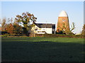
tower mill
function:Corn mill
- house converted
Clavering,
, undated
Entry in Mills Archive database -
#2350 - North Mill, Clavering
Windmill at Clavering
[2014-06-28]
- HD
Bikeboy
Clavering: North windmill
[2006-11-18]
Nigel Cox
Clavering: Disused windmills
[2006-11-18]
Nigel Cox
(4) Geograph images are licenced under a Creative Commons Attribution-Share Alike licence
Wikipedia entry
[
StreetView ]
North tower mill Photos: (1) Farries 1 (a) stone assembly, 1941
Property details at Zoopla
Flickr images are copyright their individual photographers.
Show 11 Flickr images
Images from Historic England - hover over image to see copyright info, and to enable zoom
Mill End, Clavering, Uttlesford, Essex, CB11 4RR
6 Jun 2004 - Photograph (Digital)
International Mill Database Entry
name
North Mill
id
59587
description
Wind power was used here until 1919; the machinery was then run by an oil engine until the
1950s; the mill was converted to residential use around the year 2000, prreserving some of
the machinery
drive power recent
none
drive power originally
windmill
mill type
tower mill
function type
grain mill
condition type
technique
use today
private residence
map location
51.974365,0.1339
country
United Kingdom
state
England
county
Essex
municipality
Saffron Walden
city
Clavering
zip
CB11 4RL
street
Mill Lane
logo detail
windmill_tower
picture
136910
photographer name
Willem van Bergen
construction year
1811
picture name
GB-ClaveringEssexNorthMill_01_ID59587_WillemVanBergen_1977.JPG
picture url
https://milldatabase.org/image/136910/download


 (