Cambridge
#2344
Search:
Google images eBay wikipedia YouTube
NGR:
TL445599
(
52.21880 ,
0.11464 )
Map/aerial photo of the area around the mill
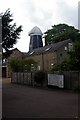
French's Mill :
smock mill
function:Corn mill
- converted to offices
Chesterton, Cambridge,
, 22/6/80
Entry in Mills Archive database -
#2344 - French's Mill, Chesterton, Cambridge
(has photos )
Muggeridge Collection photos
French's Mill
[2007-07-06]
Tiger
(1) Geograph images are licenced under a Creative Commons Attribution-Share Alike licence
[StreetView ]
New Chesterton, French's Mill ,
smock mill Photos: (1) NMR (a) disused with cap (2) A C Smith (WIC) (a) derelict with cap, May 1974 (3) NMR (WC) (a) w/o (4) CCL (a) w/o (5) UOK (MC) (a-b) disused with cap, April 1933 (6) NCL (RW) (a) w/o
Flickr images are copyright their individual photographers.
Show 18 Flickr images
Images from Historic England - hover over image to see copyright info, and to enable zoom
French's Road, Cambridge, Cambridgeshire
4 Feb 2007 - Photograph (Digital)
International Mill Database Entry
name
Chesterton Mill aka French's Mill
id
59623
description
Former smock mill, converted to office space
drive power recent
none
drive power originally
windmill
mill type
smock mill
special construction
octagonal
function type
grain mill
condition type
no technique
use today
office
map location
52.218785,0.11469
country
United Kingdom
state
England
county
Cambridgeshire
municipality
Cambridge
city
Cambridge
zip
CB4 3NP
street
French's Road
logo detail
windmill_nophoto


 (
(