Cottenham
#2342
Search:
Google images eBay wikipedia YouTube
NGR:
TL444674
(
52.28561 ,
0.11572 )
Map/aerial photo of the area around the mill
tower mill
function:Corn mill
- now used as water tower
Cottenham,
, 22/6/80
Entry in Mills Archive database -
#2342 - Tower mill, Cottenham
[
English Heritage ]
Muggeridge Collection photos
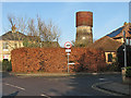
Cottenham: the corner of Rampton Road and Lambs Lane
[2016-12-27]
- HD
John Sutton
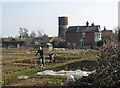
Cottenham: spring work on the allotments
[2013-03-05]
- HD
John Sutton
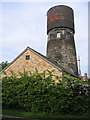
Windmill turned water tower, Cottenham, Cambs
[2006-05-28]
Rodney Burton
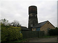
Converted water tower in Cottenham, Cambridgeshire
[2005-03-00]
Nat Bocking
(4) Geograph images are licenced under a Creative Commons Attribution-Share Alike licence
Listed Building, Grade II:
TOWER MILL
(listed 1984-09-14)
tower mill Photos: (1) NMR (a-b) tower with water tank (2) A C Smith (a) tower with water tank, September 1972 (3) photo shown at SMS Windmill Meeting, with 12 sails (4) CCL (a) with 12 sails, but some damaged/dislodged after gale (5) UOK (MC) (a) tower with water tank, August 1937
Flickr images are copyright their individual photographers.
Show 6 Flickr images
Images from Historic England - hover over image to see copyright info, and to enable zoom
Cottenham Tower Mill, 100 Lamb's Lane, Cottenham, South Cambridgeshire, Cambridgeshire
Jun 1939 - Photograph (Negative)
Rampton Road, Cottenham, South Cambridgeshire, Cambridgeshire, CB4 8UL
13 Sep 2005 - Photograph (Digital)
International Mill Database Entry
name
Cottenham Windmill
id
59627
description
Disused tower mill, converted to a water tower
drive power recent
none
drive power originally
windmill
mill type
tower mill
function type
grain mill
condition type
no technique
map location
52.28561,0.11572
country
United Kingdom
state
England
county
Cambridgeshire
municipality
Cambridge
city
Cottenham
zip
CB24 8SH
street
Manse Drive
logo detail
windmill_nophoto


 (
(