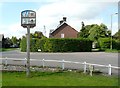
Great Offley
#2276
Search:
Google images eBay wikipedia YouTube
NGR:
TL133269

(
51.92897,
-0.3533)
Map/aerial photo of the area around the mill
Tower mill function:Corn mill
- truncated
[
info]
Entry in Mills Archive database -
#2276 - Tower mill, Great Offley
Muggeridge Collection photos
(1) Geograph images are licenced under a Creative Commons Attribution-Share Alike licence
Flickr images are copyright their individual photographers.
Images from Historic England - hover over image to see copyright info, and to enable zoom
Luton Road, Offley, North Hertfordshire, Hertfordshire
2 Feb 2005 - Photograph (Digital)
|
International Mill Database Entry |
|---|
| name |
Great Offley Windmill |
| id |
10351 |
| description |
Truncated tower mill, serving as a storage space |
| drive power recent |
none |
| drive power originally |
windmill |
| mill type |
tower mill |
| function type |
grain mill |
| condition type |
no technique |
| use today |
storage space |
| map location |
51.928975,-0.353370 |
| country |
United Kingdom |
| state |
England |
| county |
Hertfordshire |
| municipality |
Hitching |
| city |
Great Offley |
| zip |
SG5 3DR |
| street |
Luton Rd |
| logo detail |
windmill_nophoto |