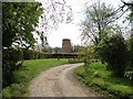
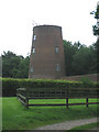
Roughton
#2150
Search:
Google images eBay wikipedia YouTube

(
52.90477,
1.29426)
Map/aerial photo of the area around the mill
Tower mill function:Corn mill
Entry in Mills Archive database -
#2150 - Tower mill, Roughton
[
Norfolk CC]
(2) Geograph images are licenced under a Creative Commons Attribution-Share Alike licence
Details from Norfolk Mills.
Listed Building, Grade II:
WINDMILL
(listed 1988-01-28)
Images from Historic England - hover over image to see copyright info, and to enable zoom
Windmill, Old Mill Road, Roughton, North Norfolk, Norfolk, NR11 8PE
31 Mar 2003 - Photograph (Digital)
|
International Mill Database Entry |
|---|
| name |
Roughton Windmill |
| id |
57457 |
| description |
House converted tower mill |
| drive power recent |
none |
| drive power originally |
windmill |
| mill type |
tower mill |
| special construction |
reefing stage |
| function type |
grain mill |
| condition type |
no technique |
| use today |
private residence |
| map location |
52.90479,1.29427 |
| country |
United Kingdom |
| state |
England |
| county |
Norfolk |
| municipality |
Norwich |
| city |
Roughton |
| zip |
NR11 8PE |
| street |
Old Mill Road |
| logo detail |
windmill_tower |
| sails |
shuttered |
| luffing |
fantail |
| picture |
140130 |
| photographer name |
Coll. Ton Meesters |
| Website link |
Norfolk Mills |
| floors count |
2 |
| picture name |
GB-RoughtonNorfolk_01_ID57457_CollTonMeesters_c1920.jpeg |
| picture url |
https://milldatabase.org/image/140130/download |