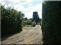
Wymondham
#2141
Search:
Google images eBay wikipedia YouTube

(
52.55681,
1.13797)
Map/aerial photo of the area around the mill
Silfield Mill:
Tower mill function:Corn mill
Entry in Mills Archive database -
#2141 - Silfield Mill, Wymondham
Muggeridge Collection photos
- 539248 - Wymondham, Front, At Work, Norfolk

- 539249 - Wymondham, After The Fire, Northfield, Norfolk

- 539250 - Wymondham, After The Fire, Northfield, Norfolk

- 539251 - Wymondham, Windshaft, After The Fire, Northfield, Nfk.

(1) Geograph images are licenced under a Creative Commons Attribution-Share Alike licence
|
International Mill Database Entry |
|---|
| name |
Silfield Mill |
| id |
57360 |
| description |
House converted tarred tower mill |
| drive power recent |
none |
| drive power originally |
windmill |
| mill type |
tower mill |
| function type |
grain mill |
| condition type |
no technique |
| use today |
private residence |
| map location |
52.556895,1.138045 |
| country |
United Kingdom |
| state |
England |
| county |
Norfolk |
| municipality |
Wymondham |
| city |
Wymondham |
| zip |
NR18 9NP |
| street |
Burnthouse Lane |
| logo detail |
windmill_nophoto |
| sails |
shuttered |
| Website link |
Norfolk Mills |