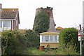
East Wittering
#1869
Search:
Google images eBay wikipedia YouTube

(
50.76985,
-0.8713)
Map/aerial photo of the area around the mill
Tower mill function:Corn mill
Entry in Mills Archive database -
#1869 - Tower mill, East Wittering
Muggeridge Collection photos
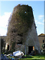
East Wittering Windmill, West Sussex
[2009-03-08]
Justin Brice

(2) Geograph images are licenced under a Creative Commons Attribution-Share Alike licence
Wikipedia entry
Flickr images are copyright their individual photographers.
Images from Historic England - hover over image to see copyright info, and to enable zoom
Church Road, West Wittering, Chichester, West Sussex, PO20 8PU
5 Oct 2002 - Photograph (Digital)
|
International Mill Database Entry |
|---|
| name |
East Wittering Mill |
| id |
51239 |
| description |
Derelict tower mill, partly overgrown
|
| drive power recent |
none |
| drive power originally |
windmill |
| mill type |
tower mill |
| function type |
grain mill |
| condition type |
abandoned |
| map location |
50.76985,-0.87139 |
| country |
United Kingdom |
| state |
England |
| county |
West Sussex |
| municipality |
Chichester |
| city |
East Wittering |
| zip |
PO20 8PU |
| street |
23 Windmill Court |
| logo detail |
windmill_nophoto |
| sails |
cloth; shuttered |
| luffing |
fantail |