Search:
Google images eBay wikipedia YouTube

(
53.08679,
-1.6254)
Map/aerial photo of the area around the mill
Carsington Pasture Mill:
Tower mill function:Corn mill
- derelict

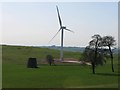
Carsington windmill, 2010 © Bob Ollerenshaw
Entry in Mills Archive database -
#1285 - Carsington Pasture Mill, Hopton

Former windmill
[2026-08-13]
- HD
Jay Pea


Old Windmill near to Carsington Pastures
[2005-10-18]
Phil Berry
(3) Geograph images are licenced under a Creative Commons Attribution-Share Alike licence
Listed Building, Grade II:
WINDMILL
(listed 1983-10-11)
Flickr images are copyright their individual photographers.
Images from Historic England - hover over image to see copyright info, and to enable zoom
Windmill, Brassington Road, Hopton, Derbyshire Dales, Derbyshire
9 Oct 2002 - Photograph (Digital)
|
International Mill Database Entry |
|---|
| name |
Carsington Pasture Mill |
| id |
58083 |
| description |
Disused stone built tower mill, left abandoned in the middle of a field |
| drive power recent |
none |
| drive power originally |
windmill |
| mill type |
tower mill |
| function type |
grain mill |
| condition type |
abandoned |
| map location |
53.08686,-1.62548 |
| country |
United Kingdom |
| state |
England |
| county |
Derbyshire |
| municipality |
Matlock |
| city |
Hopton |
| street |
Manystones Lane |
| logo detail |
windmill_nophoto |

 Hopton_Windmill_03.jpg
 Hopton_Windmill_01.jpg
 Hopton_Windmill_02.jpg