Windmill World logo

Sharnbrook windmill, Bedfordshire


Sharnbrook #1723

NGR: SP998593
(52.22302,-0.5407) OS map + aerial, Google Maps Aerial - Google Map + Virtual Earth


Map/Aerial photo of the area around the mill

tower - converted to observation tower


Sharnbrook, 14/10/2001

Entry in Mills Archive - #1723 (login required)

Entries in photo archives: [UKMills]

Sharnbrook Windmill [2006-02-11]

Colin Mitchell

Geograph images are licenced under a Creative Commons Attribution-Share Alike licence
Details from the English Windmills Photographic Register by Guy Blythman
tower mill
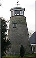
Photos: (1) Howes (a) derelict with cap and tailpole, 1937 (2) NMR (a-l) as Howes (3) A C Smith (WIB) (a) house converted tower with observatory on top, May 1971 (4) BM vol 3 p34 (a) interior view showing upright shaft and great spur wheel with parts of wallower and brakewheel visible (5) BM vol 18 p184 (a) derelict with 4 sails, cap and tailpole (6) UOK (MC) (a) derelict with cap and tailpole, July 1933 (b) derelict with cap and tailpole, August 1934 (c) winch on end of tailpole, August 1934


[Windmills] [Watermills] [Bookshop] [News] [Site map] :

Last updated 16/07/2010 Text and images © Mark Berry, 1997-2010 -